By Cole Stover, Oregon State University
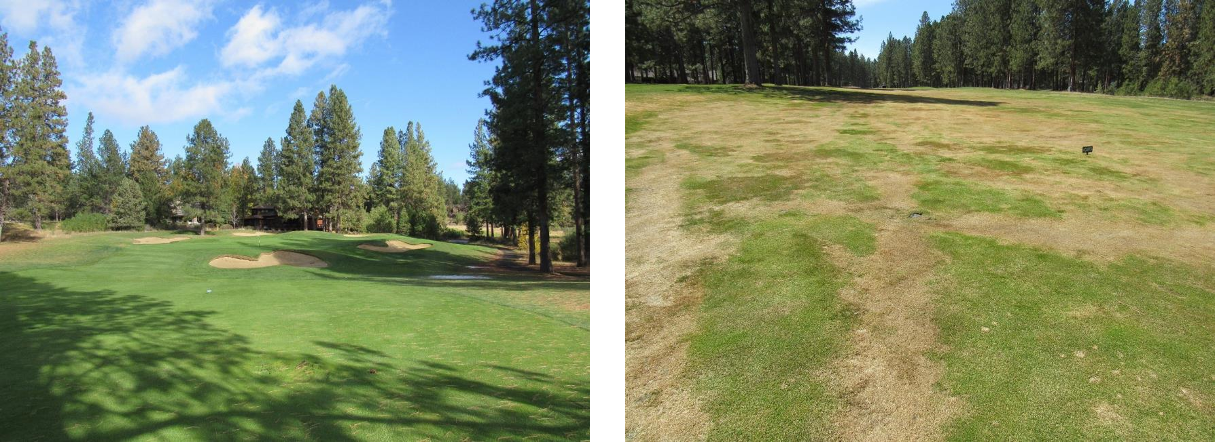
As part of the WinterTurf project, researchers in Minnesota and Oregon are conducting unmanned aerial vehicle-based sensing of golf courses in each of their states. In central Oregon this year, winter conditions and snowfall came early in November and lingered into early to mid April. Our preliminary findings (Figures 1 and 2) show extensive damage from lasting snow cover with daytime temperatures that promoted a cycle of freezing and thawing in fairways and on greens at several of the golf courses in the region. The areas suffering the most damage were shaded for much of the winter by trees and slopes. Lower areas and depressions where water could gather seemed to be more harshly affected.
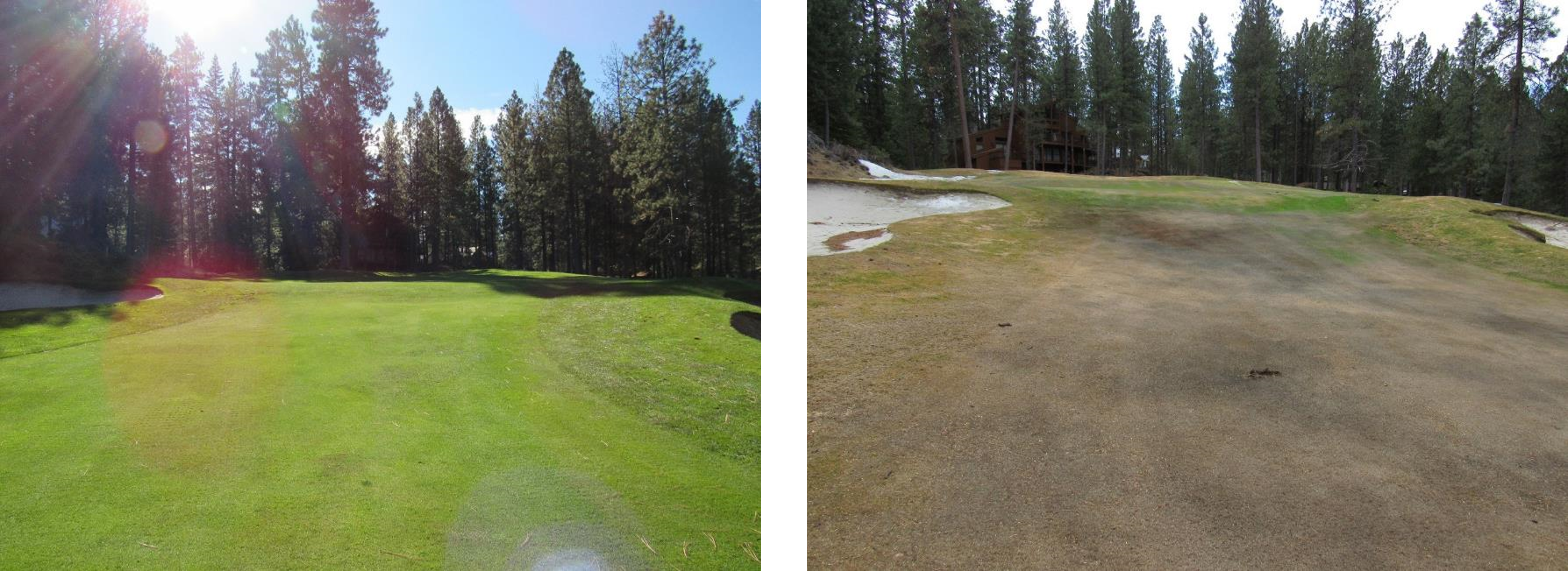
We are determining whether remote sensing with a drone can help monitor and track snow and ice cover over the whole course as a way to detect turfgrass health. This would allow for the development of drone-based approaches used in winter so turf managers could plan more effectively for spring management.